Location Map
Event 15 - 08 Jul 2019
Event 14 - 08 May 2019
Event 13 - 24 Apr 2019
Event 12 - 6-7 Apr 2019
Event 11 - 19 Mar 2019
Event 10 - 02 Feb 2019
Event 9 - 12 Aug 2018
Event 8 - 29 Jul 2018
Event 7 - 22 Jul 2018
Event 6 - 09 Jul 2018
Event 5 - 04 May 2018
Event 4 - 12 Apr 2018
Event 3 - 07 Apr 2018
Event 2 - 28 Mar 2018
Event 1 - 25 Mar 2018
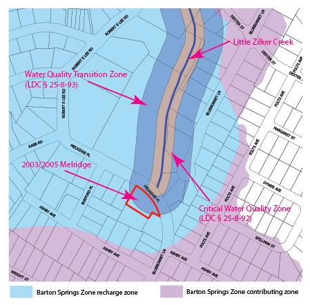
2003 & 2005 Melridge are located in the Barton Springs Zone as shown in the map to the right. The previous owner of 2003 & 2005 Melridge acquired this property and the property at 2001 Melridge in a quit claim deed dated 09 Dec 1977. In 2014, this owner of 2001/2003/2005 Melridge attempted to subdivide the two properties into three lots. The Master Comment Report for this subdivision required it to meet the SOS requirements including impervious cover restrictions and water quality ponds. The subdivision application expired without action being taken. On 16 Jun 2017, the 2003 & 2005 Melridge property was sold to the current developer. The 2003 & 2005 Meldridge property was still one unsubdivided lot with a two-family residential use consisting of two dwellings (a single-family dwelling and a duplex) on two tracts and was still in need of subdividing to create two separate properties. On 24 Jul 2017, a month after the property was sold, the previous owner filed a new warranty deed to retroactively replace the quit claim deed dated 09 Dec 1977. This new deed retroactively created three separate parcels instead of two. Thus, the new owner claimed that the parcels existed in their current configuration on August 8, 1992 even though they did not until the retroactive replacement deed of 24 Jul 2017. On 24 Jul 2017, the City issued a Land Status Determination for 2003 & 2005 Melridge excepting it from the requirement to plat. As a result, the developer was able to circumvent the SOS ordinance and the more restrictive impervious cover limits. While the deed maneuver may have been technically legal, it certainly did not meet the spirit of the SOS ordinance.
This site is also in the Water Quality Transition Zone of the Barton Springs Zone, and LDC § 25-8-482(B) prohibits development in a water quality transition zone that lies outside the Edwards Aquifer recharge zone, except for duplexes or single-family residential housing with a minimum lot size of two acres. The properties at 2003 and 2005 Melridge do not have a minimum lot size of two acres. LDC § 25-8-482(B) is not subject to the same SOS exception, so it is not clear why this part of the code was not applicable.
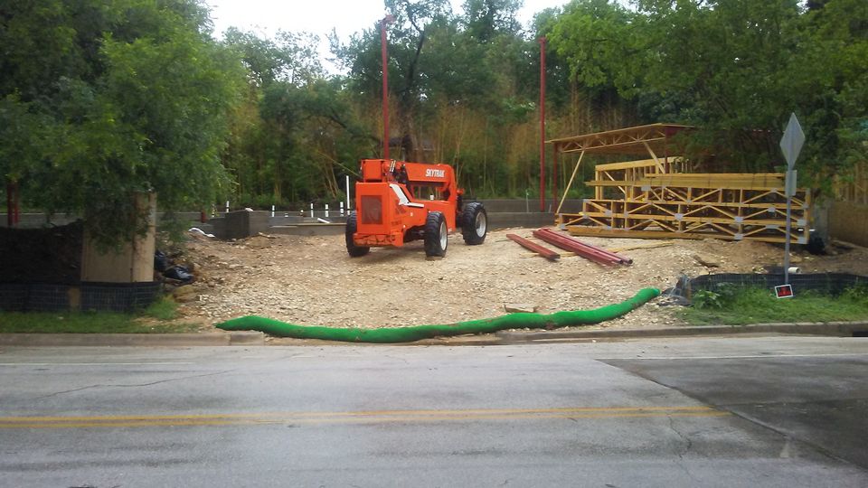
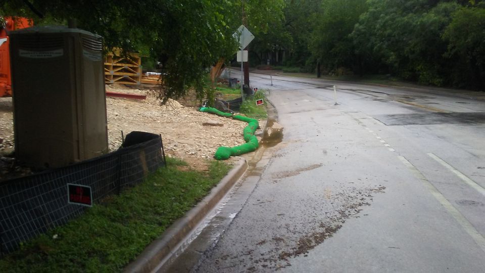
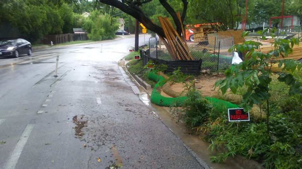
Regardless of whether LDC § 25-8-482 is applicable, special attention should be paid to development, and particularly erosion control, within the Water Quality Transition Zone of the Barton Springs Zone. This site has significant slope. If sediment in runoff is not prevented from leaving this site with adequate erosion controls, it will immediately enter Little Zilker Creek and a critical water quality zone, through the storm drains. The following photos demonstrate the issues related to this site and the potential for sediment leaving the site. This site has been reported to the City on multiple occasions. The events are arranged in reverse chronological order with the most recent event first below.
.JPG)
.JPG)
.JPG)
.JPG)
.JPG)
.JPG)
.JPG)
.JPG)
.JPG)
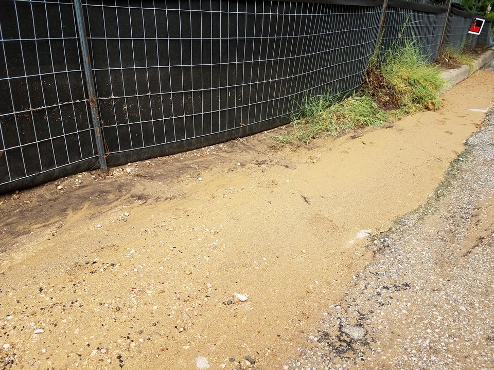
The first three photos are from April 6, before the rain on April 7. The rest are from April 7. The loose dirt and sand on the slope will wash down the hill and overtop the mulch socks when it rains.
.JPG)
.JPG)
.JPG)
.JPG)
.JPG)
.JPG)
.JPG)
Loose sand on the driveway entrance. If it rains, much of this will overflow the mulch sock or run through the gap between the ends of the mulch sock and the silt fence and wash into the street and creek.
.JPG)
.jpg)
.JPG)
This photo was taken in the evening after work had been completed for the day. If it rains, much of this will wash into the street and creek.
.JPG)
.JPG)
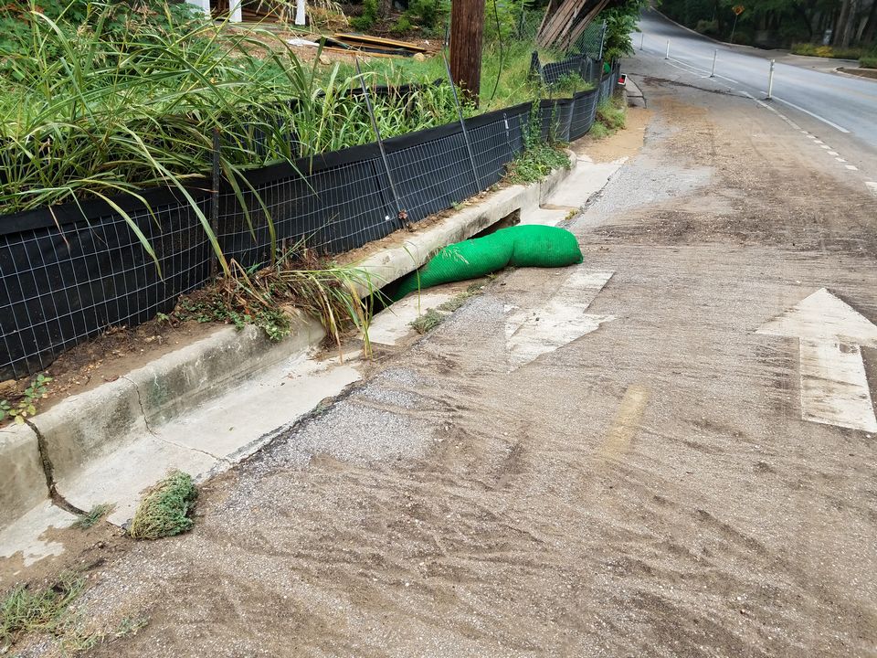
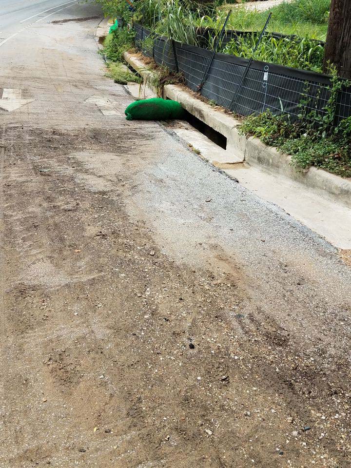
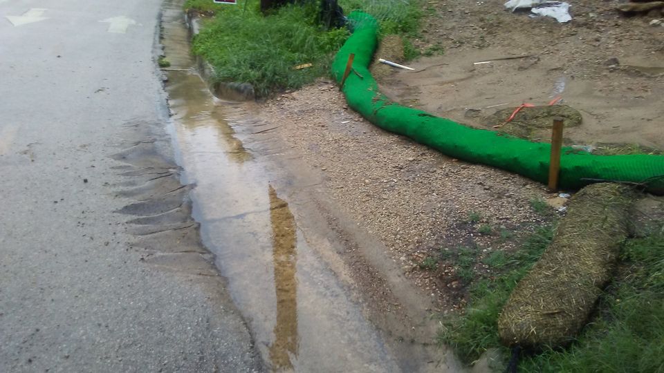
The July 9 event has repeated itself. The unstaked mulch sock has washed into the street and is lodged in the storm drain. Large amounts of sediment are in the street and mud desposited in Little Zilker Creek is clearly visible. As predicted, runoff overtopped the mulch sock and washed it into the street. Mulch socks, even staked mulch socks, are inadequate to control erosion on a site this steep.
.JPG)
.JPG)
.JPG)
.JPG)
.JPG)
The unstaked mulch sock is now lying in the gutter. Any runoff will simply overtop the mulch sock or run through the gap between the ends of the mulch sock and the silt fence. The mulch sock will likely be washed down the street.
.JPG)
The mulch on the lower part of the hill that washed off during the July 9 event has been replaced. The mulch socks that washed into the street during the July 9 event have been placed back on the entrance.The mulch socks are still not staked. If it rains, sediment will once again leave the site.
.JPG)
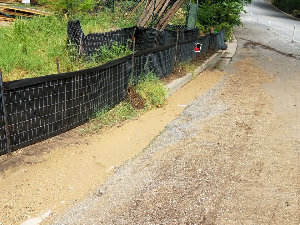
The unstaked mulch socks that were probably across the driveway have washed into the gutter. Mulch that had been on the lower part of the hill has washed away and down the storm drain. Sediment is leaving the site through the now-uncontrolled entrance gap and the crushed silt fence. This site was reported to the City for the sixth time on July 9, 2018.
.jpg)
.JPG)
.JPG)
Photos 2-5 were taken at the end of a rainfall event. Comparison of Photo 1 and Photo 2 shows how much sediment was washed off of the site. In Photo 1 (taken prior to the rainfall event), you can see how much loose soil is mixed in with the rock. In Photo 2 (after the rain), basically all that is left is the rock. The loose soil has been washed away, much of which is still visible in the gutter. Photos 6-9 were taken two days after the rainfall event. This site was reported to the City for the fifth time on May 7, 2018.
 cropped.jpg)
.JPG)
.JPG)
.JPG)
.JPG)
This site was reported to the City for the fourth time on April 13, 2018.
.JPG)
.JPG)
.JPG)
.JPG)
.JPG)
.JPG)
This site was reported to the City for the third time on April 9, 2018.
.JPG)
.JPG)
.JPG)
.JPG)
.JPG)
.JPG)
.JPG)
.JPG)
This site was reported to the City for the second time on March 28, 2018.
.JPG)
.JPG)
.JPG)
.JPG)
This site was reported to the City on March 25, 2018.
.JPG)
.JPG)
.JPG)